Thomson had a busy 2022 survey season with projects encompassing estuarine, intertidal, subtidal and offshore sampling. Collecting benthic macrofaunal and sediment data for infrastructure development projects to environmental monitoring gave us a wide breadth of work to cover over the past year.
On the Thames
Our survey staff were busy on the Thames, providing multiple clients with ecological assessments, characterising the intertidal and subtidal environments for developments along the waterfront. In the subtidal, we deployed Day grabs to take sediment samples of the riverbed for macrofaunal and Particle Size Analysis (PSA). For macrofaunal samples, the volume of collected sediment is measured in the grab, before washing it over a specific mesh size. Photographs are taken before and after the sieving process. Characteristic fauna and sediment are described in the field before then being preserved for identification later back at the lab. Collecting benthic samples allows our taxonomists to determine species diversity and also their abundance and biomass, where required. Alongside these macrofaunal data, PSA allows us to assess the distribution of different sediment types in the benthos, which, when combined with our knowledge of the fauna present, allows us to determine specific biotopes (characterised areas where combinations of certain fauna and physical features are likely to be found).
At low tide, we undertook intertidal Phase 1 walkover surveys, providing information on the distribution and extent of habitats and communities on the foreshore. Data were collected following guidelines set out in the Handbook for Marine Intertidal Phase 1 Biotope Mapping Survey (1). The extent of individual biotopes was mapped using GIS by going along the boundary of each area, with noteworthy fauna or features recorded if identified, with periodic digging carried out to aid identification of infauna. The individual biotopes were defined by using the Marine Habitat Classification for Britain and Ireland (2).
In Harwich
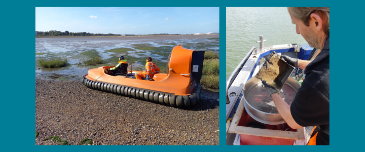
Walkover surveys can be a very muddy business and not the easiest to carry out on soft sediment. However, there are some other ways at hand which actually do not require much walking on mud. In Harwich, Thomson carried out a survey using a hovercraft to evaluate intertidal biotopes. This proved to be very efficient and allowed our survey staff to cover a considerable area of 65 ha, mapping nine different biotopes within a single spring low tide.
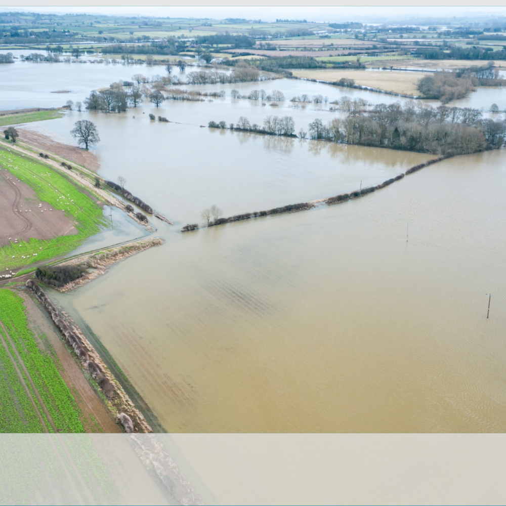
Subtidal surveys were also undertaken in the Stour and Orwell estuaries (Harwich), one of the projects being our annual benthic monitoring carried out on behalf of Harwich Haven Authority, something we at Thomson have done for many years. The collected information aids in the understanding of the macrofaunal communities present in the area and allows insights into ecological trends. This is particularly important for the Stour and Orwell estuaries, as they are a designated Ramsar Site (International directive), a Special Protected Area (EU directive) and a Site of Special Scientific Interest (UK directive), due to the presence of an estimated 50,000 birds that use the mudflats and marshy areas for wintering (3).
On the Medway
Further infrastructure development projects took the Thomson survey team to the River Medway. We employed a benthic beam trawl targeted at fish in the subtidal to characterise the fish communities within and outside the project location. This was coupled with an intertidal walkover and a subtidal grab survey for macrofaunal and PSA samples, giving a rounded picture of the environment.
In the West of Walney MCZ
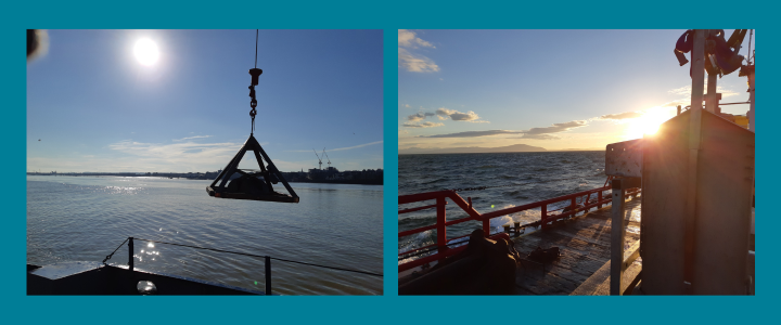
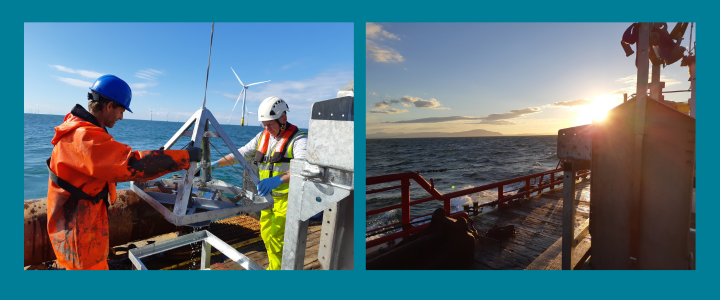
All the projects mentioned so far have not been too far from the shore or still on it. However, we also undertook an offshore survey off the coast of Cumbria in the Irish Sea on behalf of North West Wildlife Trusts. Our environmental monitoring took place within the West of Walney Marine Conservation Zone (MCZ) to assess the recovery of benthic macrofaunal assemblages to create a baseline to aid with monitoring going forward. The MCZ was established in 2016 due to the presence of subtidal mud and sand, home to rare sea pens and burrowing megafauna communities. Bottom towed fishing was banned within the MCZ in 2019 to bring about further protection.
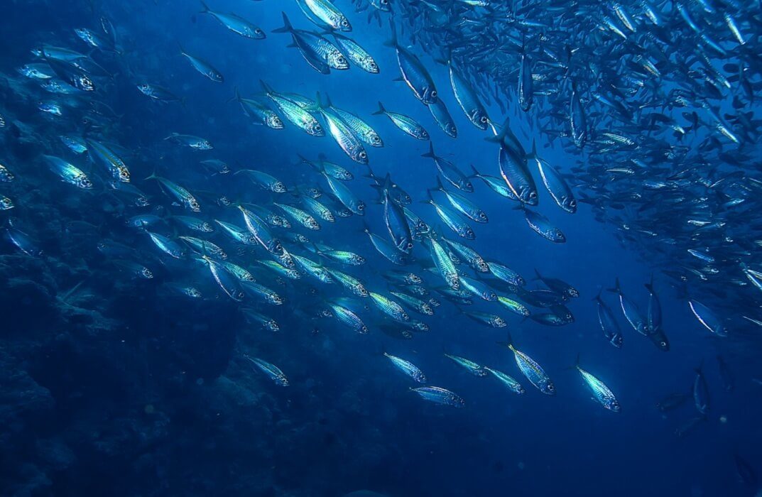
Sediment samples were taken for macrofaunal analysis, PSA and also for Total Organic Content (TOC). Three Day grabs were taken at each location, alongside a box core which collected a substantially greater amount of sediment to be processed in comparison. The 15km distance offshore to sampling sites meant very early starts and a three-hour long journey to and from site. However, we were rewarded by beautiful, if somewhat chilly, sunrises on some of the days. The motives behind designating this area as MCZ was clear to see. We found plenty of interesting animals in our sieves, such as the huge green spoon worm Maxmuelleria lankesteri (also featured in this current Deep Blue issue), other typical burrowing megafauna, like the mud shrimps Callianassa subterranea and Upogebia deltaura, and many, many brittle stars.
Thomson is now looking ahead to the 2023 survey season and we are expecting another productive and busy season, where we will continue to provide expert environmental support to our clients for their offshore and nearshore projects.
References
1. Wyn G., Brazier P., Birch K., Bunker A., Cooke A., Jones M., Lough N., McMath A. & Roberts S. (2006). Handbook for Marine Intertidal Phase 1 Biotope Mapping Survey. Report from Countryside Council for Wales.
2. Connor D.W., Allen J.H, Golding N., Howell K.L., Lieberknecht L.M., Northen K.O. & Reker J.B. (2004). The marine habitat classification for Britain and Ireland, Version 04.05 JNCC, Peterborough. Available online: www.jncc.gov.uk/MarineHabitatClassification.
3. Harwich Haven Authority (2023). Environment Designations. https://hha.co.uk/environment/designations/ (Accessed 15/03/2023)
Photographic credits
All figures by Dr Bruce Mostert, Thomson Environmental Consultants.