We have extensive experience of using aerial and satellite imagery to create maps in a variety of locations and environments – previous projects have been as diverse and varied as the Norfolk Broads to the deserts of Saudi Arabia!
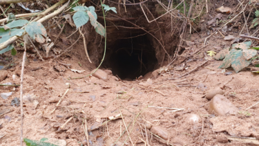
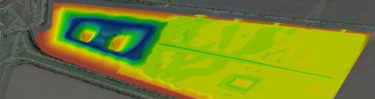
We can create habitat maps to show the geographic distribution of different habitats within a particular area using aerial or satellite imagery and complex GIS models (including machine learning and Artificial Intelligence) to interpret and extract information from images. This can save time compared to traditional survey techniques and lets us undertake work in areas that may normally prove difficult.
These techniques can provide baseline mapping as well as provide regular and ongoing monitoring. Increasingly we are using our own UAVs (drones) for these surveys to get higher quality imagery for more accurate habitat mapping on sites. You can read more here
You can read more about some of the habitat mapping work on our projects page
You can also experience some of these maps from previous projects with our innovative StoryMap
Thomson’s GIS specialists can also create these StoryMaps for your own projects offering a new and exciting way for you to distribute your data!
Want to know more ?
Contact us for a chat with one of our knowledgeable specialists
-
![]()
-
![]() GIS Technical Lead
GIS Technical Lead