The brief
The Southwest Strategic Regional Coastal Monitoring Programme is a collaboration between local authorities, the Environment Agency and other government bodies and coastal groups. It aims to provide a method of monitoring the coastal environment in the South West.
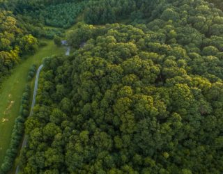
The programme covers over 1000 km of open coastline from Portland Bill in Dorset and Beachley Point in Gloucestershire, terminating at the Welsh border to join seamlessly with the Wales Coastal Monitoring Programme. Thomson Ecology was commissioned in 2015 to undertake the ecological mapping requirement of the programme for four out of the five work packages, to provide freely available Priority Habitat data for use by all of the programme partners to contribute to their high level biodiversity reporting and monitoring requirements. This updated the dataset created in 2008.
What we did
- We refined, developed and updated the broad methodology in consultation with Teignbridge Borough Council on behalf of Southwest Strategic Regional Coastal Monitoring Programme.
- We reclassified the Integrated Habitat System codes applied in 2008 to priority habitat codes.
- We mapped the extent of all coastal and terrestrial habitats for a study area of 80,000 hectares by interpreting aerial imagery acquired between 2012 and 2014 and comparing this with habitat data mapped in 2007 and Ordnance Survey Mastermap.
- We undertook field surveys of sites where there was evidence of change, where priority habitat communities were uncertain, and where there was proximity to nationally or internationally designated sites. The field surveys checked the type and extent of habitats present, collected photographic evidence and listed notable species and assessed habitat condition.
- We identified areas of invasive species, such as Hottentot fig, which could be targeted for future management and control.
- We presented the results at the annual Plymouth Coastal Observatory Partners Meeting.
The outcome
We delivered GIS data (ESRI geodatabases and MapInfo tables), technical report and field survey sheets to meet the Partnership’s biodiversity requirements.
-
Plymouth Coastal Observatory / Teignbridge District CouncilLocation
-
South West England
Services offeredIt was interesting to see how coastal habitats along the southwest coast have changed over time. This highlights how important measuring change is for such dynamic habitats.Thomson project manager, coastal habitat mapping, South West -
Our other projects


We cover all aspects of environmental consultation – from smaller surveys through to strategic projects.

At Thomson, we strive to deliver a pragmatic and innovative approach to environmental compliance.
Working in partnership with our clients, our team of environmental specialists ensures objectives are met, with maximum efficiency for our clients, and minimal impact on the natural world.