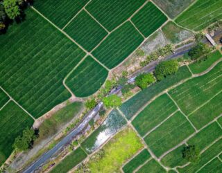
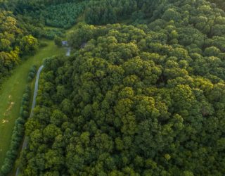
Through our drive for innovation we are leading the way with the use of UAV (Unmanned Aerial Vehicle) surveys in the ecology sector. We use high specification UAV mounted photographic equipment to capture high definition images and video footage. Controlling both camera and UAV from the ground allows us to obtain data from locations where access or visibility is limited. The flexibility and ease of deployment of the UAV means that data can be collected quickly and affordably.
Recently we undertook a flight to capture aerial imagery of six enclosures within the New Forest Wildlife Park housing Eurasian otters (Lutra lutra). The flight was undertaken to assist with the accurate mapping of the otter enclosures as part of a PhD study investigating potential methodologies for the detection of otter DNA from soil samples (eDNA).
As well as providing high quality photography and video footage of a site, we also provide a service to digitise habitats and provide Phase 1 reporting. We are able to compare habitats for the UAV collected imagery, with images collected from older aerial imagery, and can then use the information to monitor and quantify changes in habitat.
We are able to undertake ecological surveys such as bat roost inspections and water vole surveys in locations where working at height or the use of a boat might make surveying costly or unsafe.
We are able to create 3D models of a site that can be used to record progress, assisting at the design and reporting stages.
Thomson Ecology is licensed with the Civil Aviation Authority and insured for aerial photography work.