The Brief
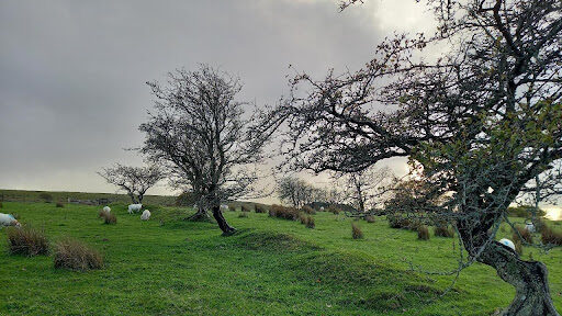
We were commissioned by Natural Resources Wales to undertake a large-scale hedgerow survey across two strategic areas to the north and west of Cardiff.
The aim was to improve understanding of landscape connectivity for species of conservation concern and to inform future hedgerow management, restoration and creation initiatives.
Between November and December 2022, a total of 696 hedgerows were surveyed across a study area exceeding 20,000 hectares
Our Approach
Innovative GIS & AI Mapping
To efficiently map the extensive hedgerow network, our GIS team developed a bespoke deep learning Artificial Intelligence tool to automate polygon mapping.
- Automated recognition accurately identified hedgerow boundaries
- Outputs were thoroughly quality assured by our GIS specialists
- Tight programme deadlines were met without compromising data quality
This collaborative approach between ecology and GIS teams significantly enhanced project efficiency.
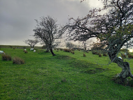
Field Survey & Data Capture
Hedgerows within defined ‘connectivity corridors’ were surveyed using a bespoke pro forma based primarily on the Defra Hedgerow Survey Handbook.
Field data collection included:
- Structural and species composition data
- Connectivity indicators
- Geo-tagged photographs
- Real-time synchronisation to secure servers via mobile data
This ensured immediate availability of survey data for project managers and the client, enabling rapid review and assurance.
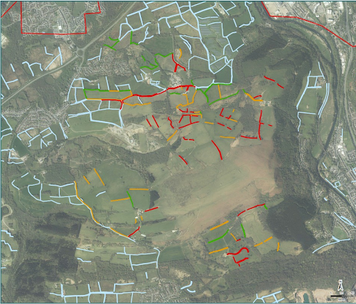
Connectivity Analysis
We developed a bespoke hedgerow connectivity metric, drawing on key survey attributes relevant to wildlife movement and habitat linkage.
Each hedgerow was assigned a connectivity score and categorised as:
- Low
- Moderate
- High
Results were presented using colour-coded mapping to visually illustrate connectivity patterns across the landscape.
Targeted connectivity assessments were also provided for selected species, including bats, dormice and hedgerow birds.
Outcomes
- Successful survey of 696 hedgerows across a large landscape-scale study area
- High-accuracy AI-supported habitat mapping
- Clear, visual connectivity outputs to support strategic decision-making
- Evidence-based recommendations for hedgerow creation, restoration and enhancement
- Timely delivery through strong internal and client collaboration
Combining ecological expertise and advanced GIS technology to inform landscape-scale conservation planning.
-
Natural Resources WalesLocation
-
Cardiff, South Wales
Services offered -
Our other projects


We cover all aspects of environmental consultation – from smaller surveys through to strategic projects.

At Thomson, we strive to deliver a pragmatic and innovative approach to environmental compliance.
Working in partnership with our clients, our team of environmental specialists ensures objectives are met, with maximum efficiency for our clients, and minimal impact on the natural world.