Armed with a pair of wellies, most children see the fun in a puddle of mud. For Thomson’s marine laboratory scientists, a bucket of mud is just as exciting. Why we feel this way may be about as clear as the bucket’s muddy content, but there is a lot to be learnt from a sample of sediment. The millions of tiny particles that make up our samples all have an incredible history, formed by erosion, decomposition, and biological waste. And these particles form the foundation of an area’s physical environment and underpin the biological processes taking place there. So, understanding an environment and its ecosystem starts with the sediment substrate and, at Thomson, the investigation begins with Particle size analysis (PSA).
What is Particle size analysis (PSA)?
From clay to boulders, sediment can vary dramatically. The aim of PSA is to determine the variety of sizes of particles that form the sediment. This particle size distribution, presented on a defined scale, such as the Wentworth Scale, can be used to categorise the sediment type. The sediment descriptions are standardised by giving the least to the most abundant size classes present. For example, a sediment that is mostly sand, with some mud and a little gravel would be described as ‘gravelly muddy sand’.
How do we do it?
At Thomson’s in-house PSA laboratory suite, trained members of staff use sieving and laser diffraction analysis methods. Sample processing begins by splitting fine (<1mm) and coarse (>1mm) material. A subsample of the fine sediment is then analysed using laser diffraction. This is the world’s most widely applied method for PSA, producing consistent and robust data to <0.01 µm. Our laser machine suspends the sediment through a cell window, which is illuminated by a laser beam. The particles cause the light to scatter, with the refraction angle depending on the size of the particle. A photodetector measures the scattered laser intensity and, the particle size distribution is determined using a scattering model.
The coarser sediment of >1mm, sand and gravel, is analysed by sieving. The sediment is dried in the oven and our sieve stack and shaker are used to divide the material into size fractions, which are weighed individually. This data is then combined with the laser diffraction data to provide a complete particle size distribution. Grain size statistics, such as mean particle size, are then calculated and a textural group is assigned to describe the sediment.
Why do we do it?
Understanding an area’s sediment is important to a range of marine industries. Different types of sediment exhibit different physical qualities, with varying levels of stability and drainage. The physical properties of coastal and seafloor substrate can have significant implications for construction and engineering works. Particle size analysis can offer insight into the potential risks and benefits of given sediment. The installation of marine infrastructure, such as jetties, quays and pontoons, and pipelines, needs to consider the sediment during planning in order to ensure the methodology is appropriate.
As engineering work can disrupt the natural sediment system, our analysis of sediment particle size is also important for monitoring sediment movement. In the coastal zone this is important for the management of erosion and flooding. We also apply this monitoring to subtidal environments when examining the distribution of disposed of dredged material. Here we are able to explore if long term changes in sediment due to the disposal have occurred, and if these are affecting the area’s biological communities.
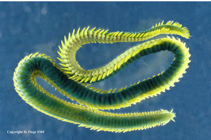
In the marine environment, there is a strong relationship between the abiotic characteristics of habitats, such as sediment type, and the biological composition of the communities. As a result, we use our particle size distributions in combination with our faunal assemblage data to characterise environments. This is done using the biotope classification scheme, which provides simplified descriptions of habitats and makes it possible to compare environments easily. Biotope data is used to assess the nature conservation value of a region. It is therefore important for licensing activities in the marine environment, which our data is often used to support. It is also important for informing marine protection and we work with governmental authorities to monitor the health of our oceans. This monitoring is also of interest to fishermen. Our PSA results, faunal assemblage data, and biotope classifications allow fishermen to understand better the benthic habitat and how it impacts on an area’s fish stocks.
If you have any requirements for sample analysis, please contact us and we’d be happy to discuss your project with you.