The Knepp Wildland Project is an innovative rewilding scheme which has seen the transformation of approximately 1000ha of formerly intensive agricultural land into a revitalised lowland mosaic of habitats.
Introduced free-ranging herbivores – red and fallow deer, Tamworth pigs, English longhorn cattle and Exmoor ponies – drive the vegetation dynamics. Monitoring how the vegetation develops over time is a key part of the Knepp scheme.
What we did
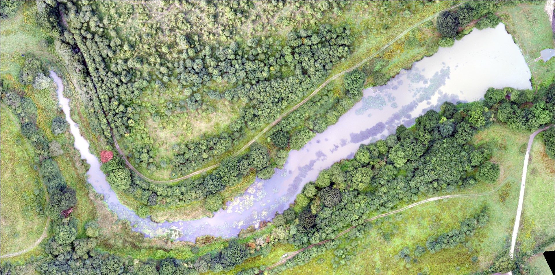
We provided Knepp Wildland Project with habitat mapping using information obtained through UAV (unmanned aerial vehicle) surveys. This enabled the client to monitor shifting habitat mosaics within the scheme.
This involved
- Undertaking UAV flights to capture high resolution aerial imagery and video. Over 3000 individual images were captured over almost 2km2. The pixel resolution of the imagery was 4cm
- Processing the imagery to produce a seamless orthorectified image mosaic
- Creating habitat maps from the image mosaic which denote areas of scrub/woodland and areas of grassland
- Producing a 3D point cloud model, allowing the study area to be navigated in a 3D environment from the viewer’s desk
- Creating Digital Surface Models (DSMs) showing relative surface elevations across the study area
- Showing geospatial comparisons between the proportions of scrub/woodland and grassland in our 2016 UAV imagery and previously captured aerial imagery.
The benefits of this information
Having current, high-resolution imagery of the Knepp Wildland Project allows the site managers to effectively monitor how the vegetation within the scheme develops.
The habitat maps created using our UAV-derived imagery were compared to habitat maps that we had created from past aerial imagery. This allowed a quantification of the change in proportions of scrub/woodland to grassland, showing that since the start of the Wildland Project the percentage of scrub/woodland had increased.
Continued periodic repeats of this process would provide an effective mechanism for monitoring the ever-changing dynamics of the mosaic habitat within the Wildland Project.
-
Knepp Wildland ProjectLocation
-
Knepp, West Sussex
Services offeredBy using UAV monitoring, the Knepp project's managers could relate developments in biodiversity to those in habitat. Being able to monitor the development of habitats is invaluable for informing research on the success of certain species, including the Purple Emperor butterfly, at the site.Thomson project manager, Knepp wildland project -
Our other projects


We cover all aspects of environmental consultation – from smaller surveys through to strategic projects.

At Thomson, we strive to deliver a pragmatic and innovative approach to environmental compliance.
Working in partnership with our clients, our team of environmental specialists ensures objectives are met, with maximum efficiency for our clients, and minimal impact on the natural world.